Flight Planning
Preparing for a flight is something every pilot does in his or her own particular way. We’re taught the basics in PPL ground school and demonstrate a prescribed method for the checkride, but it takes hours (and years even) of experience beyond the basic training for each pilot to enhance and refine their own methods.
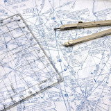
With the many technologies available today, we no longer have to rely on measuring angles and distances on paper charts to plot routes. And with several useful tools available online and for free in most cases, we can plan routes and check weather faster and with better big-picture understanding than ever. My personal favourite is still the ForeFlight iPad app, which I find excellent for both flight planning and in-flight situational awareness. They now also have an online version of their tool that is very handy for planning routes from a computer and having it automatically synced to the app. For those without a ForeFlight subscription, SkyVector is an excellent free alternative that has complete coverage in the US and some basic maps for Canada. It will now even produce a nav log that you can print out and fill in along the flight. For visualizing both forecast and real-time weather, my current favourite tool is Windyty, which also has good Android and Apple apps. Of course, the standard Nav Canada weather website should be the primary source of weather information in Canada.